A period of volatile late-winter weather has prompted flood outlook statements from both Maitland Conservation and the Ausable Bayfield Conservation Authority, as warm temperatures, freezing rain, and rain affect the region.
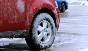
Maitland Conservation is cautioning municipalities across the Maitland and Nine Mile River watersheds that a significant freezing rain event, with ice accumulation that could reach up to 15 millimetres in some areas, may elevate river levels enough to trigger ice breakup. Recent snow surveys show the snowpack still contains between 90 and 120 millimetres of water equivalent, but with temperatures forecast to hover at or just below 0 Celcius, widespread runoff from melting snow is not expected in the immediate term.
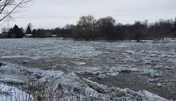
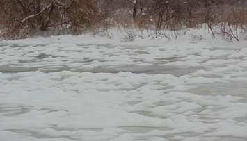
Instead, officials say the greater concern is the potential for river ice to shift and form jams. As water levels rise, ice cover can fracture and move downstream, creating sudden blockages that may lead to rapid and highly localized flooding. Ice jams are unpredictable and can develop, intensify or release with little warning, sometimes affecting areas not typically prone to flooding.
At the same time, the Ausable Bayfield Conservation Authority is expecting between 15 and 25 millimetres of rain across its watershed. Daytime highs above freezing have already begun to soften the snowpack, which currently holds an estimated 50 to 75 millimetres of water equivalent. While the snow can absorb a portion of the rainfall, saturated ground conditions are expected to produce swift runoff into local watercourses.
River modelling by ABCA suggests minor flooding is likely in low-lying, undeveloped floodplain areas, with some secondary roads that traditionally experience high water also at risk. The long stretch of cold winter weather has resulted in thick ice on many rivers and streams, increasing the possibility of ice jam flooding. Historically, the lower Ausable River between Ailsa Craig and Port Franks has faced a heightened risk of ice-related flooding, although similar issues have occurred on other waterways in the region.
Both conservation authorities are advising municipal staff to keep a close watch on drainage systems, bridges, culverts and known problem areas where water may collect. Residents are being urged to exercise extreme caution near rivers and streams, as water levels are expected to be higher and flows faster than normal. Slippery banks, unstable ice cover and frigid water temperatures add to the danger.
Officials stress that all river ice should be treated as unsafe. The current flood outlook statements remain in effect until Monday, February 23, unless conditions warrant further updates.