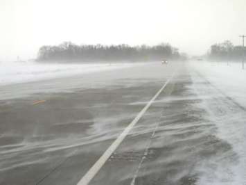
A yellow snow squall watch has been issued for north and east Lambton County.
Environment Canada says total snowfall accumulations of 20 to 40 centimetres are expected and that higher amounts are possible in some spots.
Near-zero visibility is expected in some areas with heavy and blowing snow.
Peak snowfall rates of 2 to 5 centimeres per hour are possible beginning early Sunday morning.
We're advised travel could be dangerous, and road closures are possible.
The national weather agency also said that as winds become northerly early Sunday, a particularly strong snow squall is expected to develop off Lake Huron.
The heaviest snowfall is expected west of London. However, snow squalls may move into western portions of the city at times.
Conditions are expected to improve Sunday evening.